Xiaodan Xu
Map 1: Interesting Map of the rivers in California
I googled this map of rivers in California, which may be published by www.geology.com. This map shows the main rivers and lakes that formed in CA, USA. Easily we can find that most rivers in California flow in the west-east direction. And most of the lakes are located at the east edge of the California border except the biggest lake called Salton Sea, as shown, at the bottom of the state. And obviously, we can see that in the middle part of CA, there are many streams and rivers flowing from the east to west mainly drain into rivers including San Joaquin, Salinas, Russian, Eel and Trinity Rivers, which are the main streams all the way cross California from up to bottom in the north-south direction. And the stream located on the west edge of CA mainly drain into the Pacific Ocean.
 I find this map interesting because without checking the land-shape maps of CA, you can easily estimate that there may be continuous mountains existing at the north to south direction on east part of CA. Then we can infer that the basin might locate in the middle of the CA, and that might be the reason why most rivers from the east flowing west in to the rivers in the middle of CA.
Map 2: Map of crops' transfer in the world
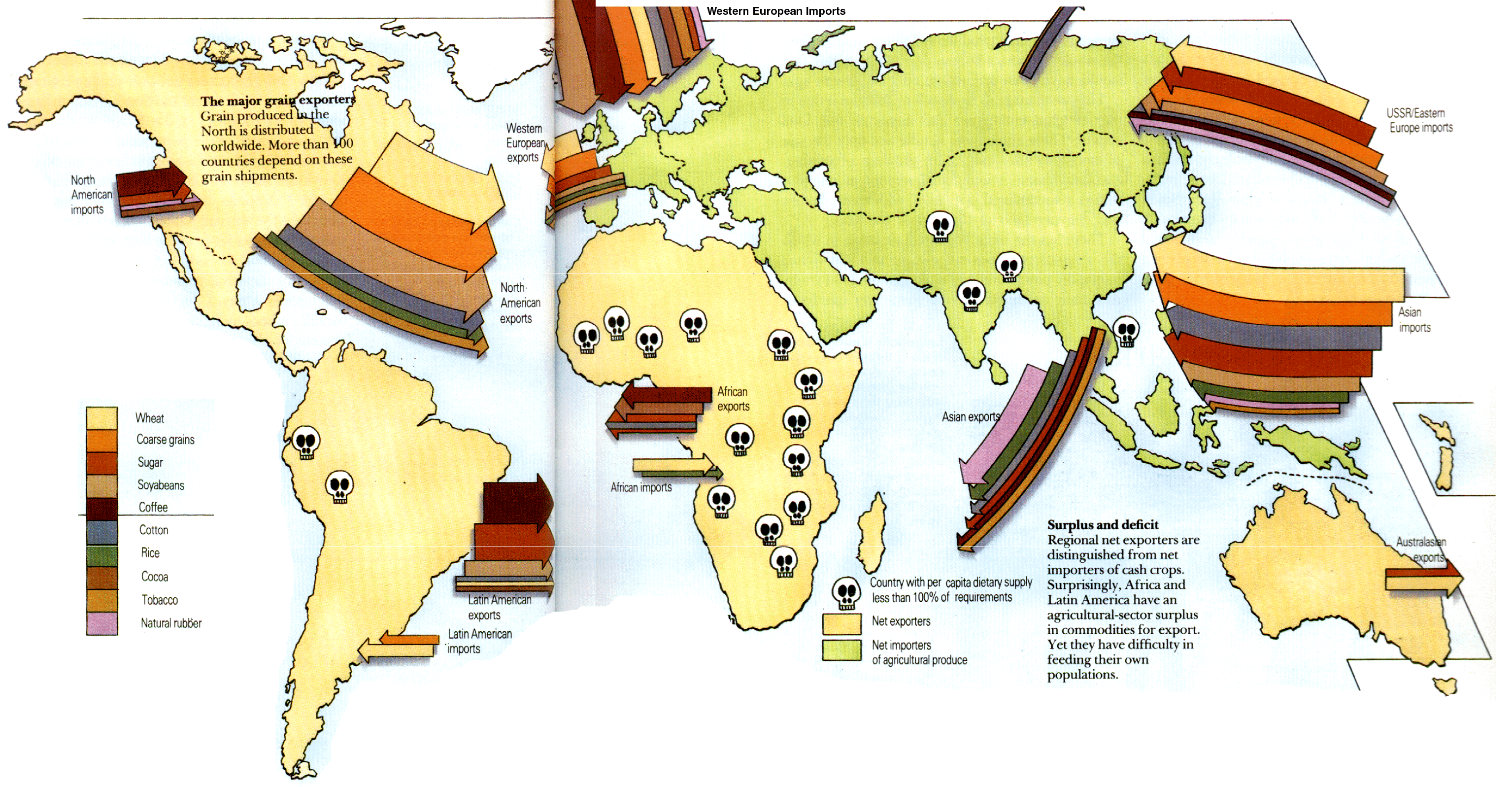
This map was published from an unclear origin, which can be found from the link www.energyenhancement.org. This map indicated how different kinds of crops transfer all over the world. By giving us the icons at the left bottom of the map, we can easily figure out what kind of crops a country or a continent exports and imports. we can tell that Europe and South Asia import the most portions of crops in the world. and the North America export the largest amount of crops individually. This map is interesting to me because it uses colorful and visual signs to show the transfer of crops around the world. it also uses the skeleton signs to vividly indicate that the parts with a skeleton is a 'death region", where crops don't grow.